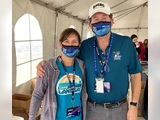
Celebrating Landsat's Anniversary and Launch with Dr. Shuman
On July 23, 2022, NASA and the U.S. Geological Survey (USGS) celebrated the 50th anniversary of the Landsat program, which acquires satellite images of all of Earth's land areas. On July 26, 2022, Senator Benjamin Cardin (D-MD) and fellow co-sponsors in the Maryland Senate introduced S. Res. 721: "A resolution celebrating the 50th anniversary of the inaugural launch of the Landsat series of Earth Observation satellites, a joint mission of the United States Geological Survey and the National Aeronautics and Space Administration." (Note: Senate resolutions are not binding law; rather, they express the collective sentiment of the Senate on a particular issue, person, or event.)
Glaciologist and UMBC researcher Christopher Shuman (NASA Code 615/UMBC) is one of many scientists who utilizes Landsat data and informs others of the discoveries from Landsat; he also contributes to outreach events and stories related to or derived from Landsat data.
From the August 1st edition of the National Snow & Ice Data Center's (NSIDC) Greenland Ice Sheet Today, "Heat Ripple", researchers discussed different aspects of the 2022 melt surge in Greenland. Dr. Shuman contributed to the discussion of the heat ripple, specifically the "excessive melt event across northern Greenland." His contributed image details NOAA Observatory's "preliminary air temperature, dew point, and air pressure reading from Summit, Greenland from July 21 - July 24, 2022," as "the melt runoff reached 10 billion tons per day on July 22." (Based on the Greenland Today article and the examination of available Landsat 8 and 9 scenes, Dr. Shuman also could support a recent Earth Observatory story regarding late July conditions over Svalbard, Norway's far north, ice-capped archipelago.) Additionally, Dr. Shuman recently gave a talk titled "Earth's Ice: Changing Now; 50 Years Of Landsat" to a group organized by the NASA Glenn Research Center's Office of STEM Engagement for the MUREP Precollege Summer Institute's (PSI) Career Connection on Climate Change.
Last September, Dr. Shuman and Valerie Casasanto (610/UMBC), ICESat-2 Mission Outreach Lead, supported outreach activities at the Landsat 9 launch from Vandenberg Space Force Base in California. Landsat is the longest civilian Earth Observation Program, with data freely available to the public, anywhere in the world. Peruse NASA's Landsat 9: Continuing 50 Years of Eyes on our Changing Planet for more information on the Landsat 9 satellite, and check out the article "A Planetary Sage: Landsat at 50" by Laura Rocchio to appreciate the vast abundance of all that the Landsat program has provided and will continue to contribute to our understanding of our planet. (You can also follow the latest news about and from Landsat on Twitter.)
According to Dr. Shuman, "A special aspect of the Landsat 9 launch was being able to meet Virginia (Ginger) Norwood who led the team that developed and flew the 'experimental' Multispectral Scanner (MSS) on the first Landsat among other notable career achievements. The MSS exceeded expectations and became the primary sensor and basis for digital Earth remote sensing on all subsequent Landsat platforms." In November 2021, Virginia Norwood was awarded the USGS John Wesley Powell Award for her contributions to USGS. Further, she inspired the Ladies of Landsat, "scientists, entrepreneurs, leaders, mothers, authors, and Landsat fans," who held a post-launch event in Lompoc, CA. Become a Landsat fan and check in with Landsat Science to see what's going on in your world, all over the planet.
Posted: August 8, 2022, 11:24 AM
